North Kyoto Cycling Route – Rider Stories
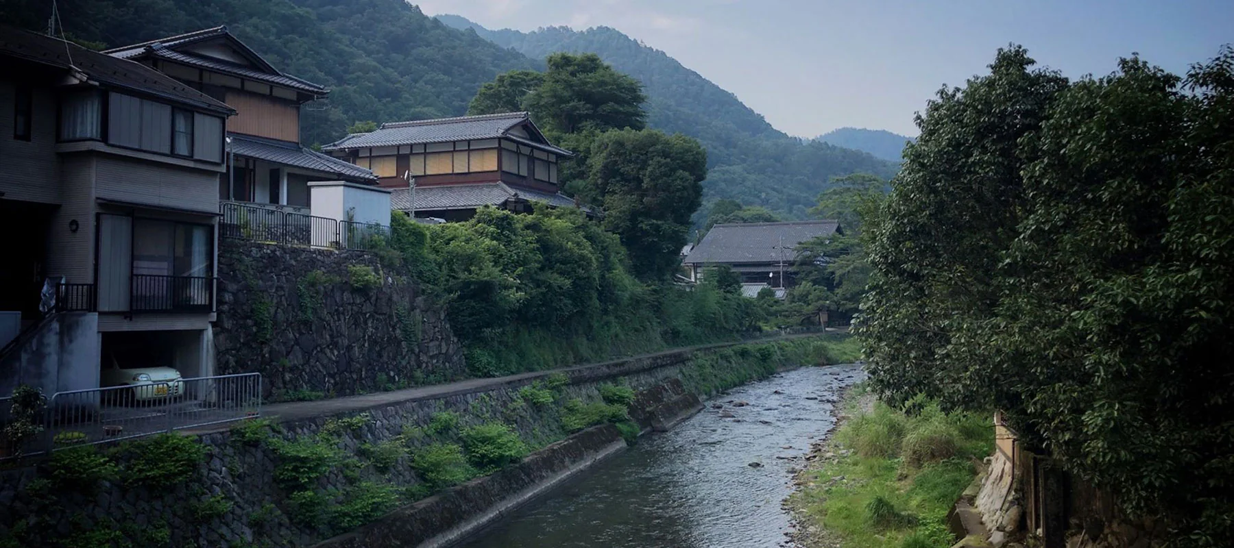
The mountains in the north of Kyoto are special – giant cedar trees, picturesque Japanese houses and farms, rivers and streams flowing from town to town and mountains with almost endless winding roads.
이미지로 주세페 시아 올라
경로
40km에서 너무 길지는 않지만 좋은 운동을하기에 충분합니다. 사이클링은 대부분 강 길, 산길이며 일부는 교토 북쪽의 교외를 통과합니다.
Distance: 40.27km
Elevation: 474m
Access from Kyoto city: Good (This is one variation on the North Kyoto Hills loop which can be extended upwards of 75km all started from RBRJ Kyoto’s location)
자전거 타는 사람

#RideNowRaceTeam
Giuseppe lives in Shanghai where he is an active member of the growing cycling community in China. When he travels he loves getting out on the bike, attacking the local surroundings and capturing parts of it with breathtaking photos. Most of the photos in this blog were taken by Giuseppe and we thank him for letting us share them with you.
Giuseppe went for two rides in Kansai and this is one of them. His other ride was an epic 140km loop down to Nara and back in searing summer temperatures.
We decided to feature his 40km ride because we think it offers so much for all levels of cyclists in Kyoto. Giuseppe had a bit of extra time in the afternoon so jumped on the bike, got his ride in and was back to enjoy his evening in beautiful Kyoto. We’re all short on time which is why we love Giuseppe’s route and we’re sure you will too.
경로에서 자전거 타기

RBRJ now offers the Cannondale Optimo 1 as an updated option
가모가와 강 출발
루트는 도시를 북쪽에서 남쪽으로 가로지르는 유명한 가모 강에서 시작됩니다. 강에는 정원이 잘 관리된 훌륭한 자전거 및 조깅 코스가 있으며 자전거로 탐험하기에 좋은 강입니다.

교토 지역 주민들은 조깅, 운동, 축구를하고 일반적으로 강의 분위기와 공간을 즐기는 사람들과 함께 강을 좋아합니다.
경로는 산조 역에서 시작하여 북쪽으로 향합니다. 강이 둘로 갈라질 때까지 계속 가면 타카노 강을 따라 올라가는 오른쪽 길을 택할 수 있습니다.

다카노 강과 산으로
강을 따라 다카라가이케 연못 공원을 지나 강을 따라 다카라가이케역 근처에서 오른쪽으로 감쌉니다.

산과 숲으로 들어가기 전에 마을의 마지막을지나 날아갈 것입니다. 도로는 천천히 고도가 높아지기 시작하며 자연의 소리, 냄새 및 광경을 접할 수 있습니다.

산길을 따라 점재하는 사원과 신사가 몇 군데 있어 들러서 구경하거나 계속 페달을 밟고 자전거에서 전망을 즐길 수 있습니다.
오하라노무라초 좌회전
다카노 강을 따라 달리는 367번 도로를 계속 올라가면 오하라노무라초(Oharanomuracho)라는 지역에 도착하여 40번 도로로 좌회전합니다.

오하라노무라초에는 강을 따라 늘어선 전통 가옥이 있어 자전거에서 멋진 볼거리를 즐길 수 있는 아름다운 풍경이 있습니다.

해발
40번 도로를 물기 시작하면 고도가 높아지기 시작하여 에너지를 태우고 멋진 리듬을 찾을 수 있습니다. 경사는 약 2km 지속되며 9.7%의 경사에 도달하여 의심할 여지 없이 심장과 폐가 작동하게 됩니다.

After the peak of the small climb you’ll start descending down the winding road through the mountain.
40번 도로는 실제로 이치하라 역을 지나 왼쪽으로 방향을 틀지만 계속 직진하여 38번 도로로 바뀝니다.

You’ll pass through an area called Shizuichiichiharacho as you make your way back towards the suburbs of Kyoto.

가모가와 강, 가미가모와 마무리
It’s here you’ll link back onto the Kamo river as you head south towards Kamigamo and into the northern Kyoto suburbs. The north of Kyoto is a lovely place with lots greenery, mountains to the west, north and east, and also some great cafes to stop at for a coffee or a spot of lunch. The route will then turn left and head along the north side of the Kamigamo golf club as you make your way east to join back onto the Takano river that you started on.

타카노 강과 가모 강을 따라 마지막 라이딩을 즐기면서 교토 중심부로 돌아가 경로를 마무리하십시오.
마무리
You won’t be disappointed taking your bike into the mountains north of Kyoto city. If you’re looking for a medium length ride with stunning scenery then we recommend trying Giuseppe’s route. He had a great couple of days riding around Kyoto (and Nara) and we appreciate him letting us share his route and photos on our blog. How about you? Do you have any favorite routes around Kyoto? We’d love to hear about your experiences cycling around Kyoto, the cultural capital of Japan.
